From NHS and NOAA; 4 PM CDT Wednesday
We now have a High Surf Advisory, A Flash Flood Watch, and a Coastal Flooding Message.
...HEAVY RAINS FORECAST TO OVERSPREAD THE GULF COAST THROUGH FRIDAY
AFTERNOON...
.THE BROAD CENTER OF A LARGE TROUGH OF LOW PRESSURE IS FORECAST TO
MIGRATE NORTHWESTWARD OFF THE GULF AND SLOWLY INLAND THE NEXT COUPLE
OF DAYS. WITH THE FORECAST CALLING FOR A SLOW MOVEMENT...THE
POTENTIAL EXISTS FOR LOCALLY HEAVY RAINS...IN BANDS...TO REPEATEDLY
MOVE OVER THE SAME AREAS OVER PORTIONS OF SOUTHEAST MISSISSIPPI
EASTWARD INTO THE COASTAL COUNTIES THROUGH FRIDAY. AS SOILS BECOME
SATURATED THE RISK OF FLASH FLOODING WILL INCREASE OVER THE WATCH AREA.
THE NATIONAL WEATHER SERVICE IN MOBILE HAS ISSUED A
* FLASH FLOOD WATCH FOR PORTIONS OF SOUTHWEST ALABAMA...
NORTHWEST FLORIDA AND SOUTHEAST MISSISSIPPI...INCLUDING THE
FOLLOWING AREAS...IN SOUTHWEST ALABAMA...LOWER BALDWIN...LOWER
MOBILE...UPPER BALDWIN AND UPPER MOBILE. IN NORTHWEST
FLORIDA...COASTAL ESCAMBIA...COASTAL OKALOOSA...COASTAL SANTA
ROSA...INLAND ESCAMBIA...INLAND OKALOOSA AND INLAND SANTA
ROSA. IN SOUTHEAST MISSISSIPPI...GEORGE AND STONE.
* FROM MIDNIGHT CDT TONIGHT THROUGH FRIDAY AFTERNOON
* THE HEAVIER RAINS ARE POSSIBLE GENERALLY SOUTH OF A LINE FROM
WIGGINS MISSISSIPPI TO CITRONELLE...BAY MINETTE ALABAMA TO
CRESTVIEW FLORIDA. LATEST FORECASTS CALL FOR STORM TOTAL RAINS OF 3
TO 5 INCHES DURING THE DURATION OF WATCH. A FEW AREAS MAY SEE LOCALLY
HIGHER AMOUNTS OF AROUND 6 INCHES.
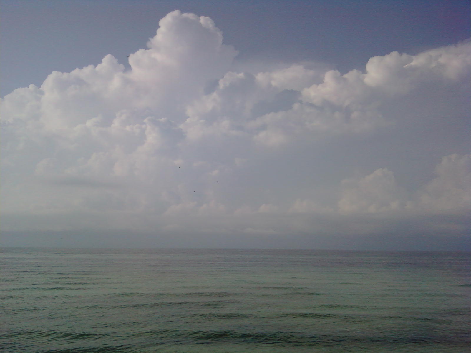
...HIGH SURF ADVISORY IN EFFECT UNTIL 10 AM CDT FRIDAY...
MODERATE SWELLS ARE FORECAST TO CONTINUE BREAKING ONSHORE ALONG THE
BEACHES OF ALABAMA AND THE WESTERN FLORIDA PANHANDLE THROUGH FRIDAY
MORNING...CREATING DANGEROUS RIP CURRENT AND HAZARDOUS SWIMMING
CONDITIONS.
THE HIGH SURF WILL LIKELY RESULT IN SOME MINOR BEACH EROSION...AS
WELL AS NUISANCE COASTAL FLOODING AS WASH MOVES OVER JETTIES AND
EXPOSED LOW LYING AREAS ALONG THE IMMEDIATE COASTLINE. MANY LOCATIONS
ALONG THE COAST...INCLUDING BAYS AND RIVERS...WILL LIKELY HAVE TIDE
LEVELS 1 TO 2 FEET ABOVE NORMAL THROUGH FRIDAY MORNING. THE
PREDICTION FOR HIGH TIDES NEAR 1 FOOT ARE FORECAST TO OCCUR AROUND
100 PM THURSDAY. THE NEAP TIDE CYCLE WILL HELP ALLEVIATE ANY
SIGNIFICANT COASTAL HAZARDS.
THE LOCATIONS MOST PRONE TO MINOR COASTAL FLOODING ARE ALONG THE OLD
MOBILE CAUSEWAY AND THE WEST END OF DAUPHIN ISLAND IN SOUTHWEST
ALABAMA...AND FORT PICKENS STATE PARK WEST OF PENSACOLA FLORIDA.
Showing posts with label Tropical Storm. Show all posts
Showing posts with label Tropical Storm. Show all posts
Wednesday, August 11, 2010
Tuesday, August 10, 2010
TROPICAL STORM WARNING
While this is, as of 11 am - Wednesday, CDT still tropical depression 5 ===============
....TROPICAL STORM WIND WARNING REMAINS IN EFFECT UNTIL 6 PM CDT
THURSDAY...
...TROPICAL STORM WARNING REMAINS IN EFFECT...
...NEW INFORMATION...
ALTHOUGH THE DEPRESSION HAS WEAKENED...SOME STRENGTHENING IS POSSIBLE
BEFORE THE CENTER REACHES THE COAST ON THURSDAY.
...PRECAUTIONARY/PREPAREDNESS ACTIONS...
PRECAUTIONARY/PREPAREDNESS ACTIONS...
FINAL PREPARATIONS TO PROTECT LIFE AND PROPERTY FROM TROPICAL
STORM CONDITIONS SHOULD BE COMPLETED BEFORE CONDITIONS
DETERIORATE. THE ONSET OF GUSTY WINDS AND HEAVY RAINS CAN CAUSE
OUTSIDE ACTIVITIES TO BECOME DANGEROUS. SECURE LOOSE OUTDOOR
OBJECTS WHICH CAN BE BLOWN AROUND. IF YOU LIVE IN A MOBILE HOME...
PLAN TO LEAVE IT FOR MORE SUBSTANTIAL SHELTER.
&&
...STORM SURGE AND STORM TIDE...
A STORM SURGE WILL ACT TO RAISE WATER LEVELS BY AS MUCH AS 2 TO 4
FEET ABOVE GROUND LEVEL ALONG THE IMMEDIATE COAST NEAR AND TO THE
EAST OF WHERE THE CENTER MAKES LANDFALL. WITH THE LATEST FORECAST
TRACK NOW BEING SHIFTED MORE EASTWARD...IT IS POSSIBLE THAT THESE
VALUES MAY BE REVISED UPWARD A BIT BUT NOT MUCH MORE THAN ONE
ADDITIONAL FOOT. ALSO REMEMBER...ACROSS OUR AREA THERE WILL BE A
RANGE OF INUNDATION WITH THE HIGHER VALUES BEING GENERALLY WEST OF
PENSACOLA AND THE LOWER VALUES A BIT FURTHER EAST WHICH WOULD BE A
GREATER DISTANCE FROM THE STORM`S CENTER.
...INLAND FLOODING...
HEAVY TROPICAL CYCLONE RAINBANDS WILL SET UP ACROSS SOUTH ALABAMA
AND THE WESTERN FLORIDA PANHANDLE LATE TONIGHT THROUGH LATE THURSDAY
AS THE CENTER OF THIS SYSTEM MOVES INLAND OVER LOUISIANA AND
MISSISSIPPI. TOTAL RAINFALL ACCUMULATIONS OF 3 TO 5 INCHES WITH
LOCALIZED AMOUNTS TO NEAR 10 INCHES IN BANDS OF PERSISTENT HEAVIER
RAINS WILL BE POSSIBLE ALONG THE NORTH CENTRAL GULF COAST REGION.
...WINDS...
AS TROPICAL DEPRESSION FIVE APPROACHES AND STRENGTHENS TO A
TROPICAL STORM...PERIODS OF TROPICAL STORM FORCE WINDS...MAINLY
IN PASSING SQUALLS...ARE EXPECTED TO BEGIN ALONG THE COASTAL REGION
BY LATE EVENING INTO EARLY THURSDAY.
...TORNADOES...
TORNADOES WILL BE MOST LIKELY TO OCCUR IN THE OUTER RAINBANDS ONCE
THE CENTER OF CIRCULATION PASSES TO THE SOUTHWEST OF COASTAL ALABAMA
AND NORTHWEST FLORIDA. REMEMBER...TORNADOES CAN DEVELOP MANY MILES
AWAY FROM THE TROPICAL CYCLONE CENTER OF CIRCULATION.
Expect higher surf 6-6 feet, and higher tides 2-3 feet above normal. Help inform guests of the flag warning system. As bad weather approached, leave the beach for your safety.
Tuesday, August 3, 2010
 All the IDs are now completed. They are at the firehouse.
A small leak in a hydraulic line during a test for static kill has delayed the attempt. We've waited this long, I guess we can soldier on longer.


The beach looks fabulous again today. The mini gnats are in full force. The June Grass is in the swim zone down by WO1 and 2, but much clearer down by 3 and 3H. There are storms just off the coast this morning, but I didn't hear any thunder. The rain yesterday certainly didn't cool us down, but my house geckos and tree frogs are enjoying the explosion of flying insects. SPEAKING of which, what's up with the migration and mating frenzy of the dragonflies the last couple of day?! Cool, eh? OH, and looks like we are up to turtle nest #6, with a nest to the EAST of WO 1. It's clear up on the dune line.
TS Colin is now swirling amok in the Atlantic. As things stand now, a frontal system should, hopefully steer it off the east coast of the US, and back out to sea, and a dry slot may keep it a Tropical Storm. BUT we all know that can change in the blink of an eye. So we'll do what we always do, hurry up and wait.

Today we have an Excessive Heat Watch. Which means we've gone from Dangerously Oppressive, to Repulsively Sticky. Heat indexes will continue to be in the 105-113 range. You know the drill: Water, loose fitting clothing, sunscreen, and take it slowly.

Unless I think of something amazing this afternoon, that's all I've got for you.
Have a great day!


Saturday, July 24, 2010
Bye Bye Bonnie

Tropical Storm Warnings have been cancelled.We do have a chance of wind gusts later today, as well as rain and thunder as what is left of Bonnie passes to our South and West. And we also have a chance of WaterSpouts later, so be on the lookout for those if you are out.
I am hoping to see increased traffic at the beach now that the immanent threat of a Tropical Blow has passed. Wave action may increase as the winds shift and start to come from the South.And from the National Weather Service.
"SAT JUL 24 2010 /355 AM CDT SAT JUL 24 2010/
...A HIGH RISK OF RIP CURRENTS EXPECTED TODAY IS IN EFFECT FROM 2
PM EDT /1 PM CDT/ THIS AFTERNOON THROUGH THIS EVENING...
INCREASING WINDS AND SEAS OUT ACROSS THE GULF WATERS DUE TO
TROPICAL DEPRESSION BONNIE PASSING TO THE SOUTH WILL LEAD TO
BUILDING SURF AND DANGEROUS RIP CURRENTS ALONG THE PANHANDLE
BEACHES TODAY.
PRECAUTIONARY/PREPAREDNESS ACTIONS...
WIND AND SURF CONDITIONS WILL SUPPORT DANGEROUS RIP CURRENTS
TODAY. RIP CURRENTS ARE LIFE THREATENING TO ANYONE ENTERING THE
WATER."
I only have one funny story to share and then I'll let you go on your way. It's not a SURF story, but a fishing one. While fishing the other night with my son, the lack of nibbles drove him to boredom. He asked to go see what the other kids at the end of the pier were catching. So he went to the other side of the octagon, where a boy his age had just pulled in a large sucker fish, a remora, which hang out under the pier, sucking on the pylons. Anyway, they got it off the hook and the bugger suctioned itself to the concrete. Watching two boys trying to get a determined slimy fish off concrete was just about the funniest thing I've seen in a long time. Then it got funnier.
I heard," Wouldn't it be funny if we got him loose and stuck him to that guy's back?" HA ! There was a man fishing about 10 feet away, sunburned, no shirt and now I was envisioning him having to explain to his wife why he had this enormous sucker hickey on his back. " Honest honey, I was out fishing!" Although with as hot as it was, maybe a giant wet slimy fish on his back would feel great. (hmmmm, new cooling invention you might see on late night TV. "Call in now and order your one of a kind, super cool cooling fish. Just $29.95! When you're done with him, you've got a handy dinner for two!") Luckily for him, they thought it out and tossed fishy back into the emerald deep.
Kids.
If you're going out today; drink your water, use that sunscreen, wear your hat, have fun and share the knowledge.
Subscribe to:
Posts (Atom)